Welcome! The intent of Anecdotes from the Trail is to share my experiences while trail running or racing (occasionally on the road too.) And to feature other trail runners and their accomplishments. You may see the occasional gear review or even contest. Please visit from time to time. Happy trails!
Showing posts with label duncan Ridge Trail. Show all posts

Wednesday, March 20, 2013

I'm a Trail Casualty: Georgia Death Race 03.16.13

Dave, me, Dustin, Brack and Drew before the start of the Georgia Death Race
I'm a trail casualty of the Georgia Death Race. There I've said it. I dropped out at mile 25. Done. Fork stuck in my back. In hind sight, I'm good with it, just like I was fine with the decision during the race despite my buddy, Brack's demands to keep going. Truth is, I knew when I signed up that it was totally unrealistic to truly be ready for this race in time. But I admit that I got caught up in the hype of the race and I wanted to be a part of its inaugural edition. With 60-ish miles on some of the toughest terrain in North Georgia, it was hard to not pay attention. I interviewed Sean "Run Bum" Blanton back in October and even got more excited about the race.

I can list three reasons why I ended up "trail kill" this past weekend: 1) I somehow managed to do well at the Mt. Mist 50K despite very low mileage going into that race. While I know that a 50K can't compare to a 100K, I obviously developed a false sense of confidence that if I could wing the first, I could at least make an attempt at the latter only six weeks later. Not! 2) I started off way too fast. It was exciting to be on the course in the dark with almost 200 fellow trail running buddies on some of the most challenging trails in Georgia. I paid for it in 25 not so short miles. It took me over seven and a half hours to cover the distance, but I lost the most time in the second half of the distance. I should have been more conservative. 3) It's simply hard as shit. I've run the Duncan Ridge Trail before. I know how tough it is (which is why I was so intrigued by this race), but I did not respect it and I paid for it. Hence, the drop at mile 25.

Despite everything, it was a great day for trail running. Let me rewind and share how it went for me up until leaving the race at Point Bravo (mile 25).

Brack, Drew, Dustin and Dave picked me up at work on Friday afternoon and we headed up to Vogel State Park. About ten miles from the park, we got stuck in traffic. Unfortunately, a female cyclist from Cumming, GA was coming down the road from Neels Gap and was ht by a car. It shut down the road for several hours while authorities investigated the accident scene. In the meantime, we were late along with several others for the scheduled 7pm obligatory race meeting. We arrived in the park around 7:45pm, checked in with our mandatory gear, picked up bibs, listen to Sean's instructions and then immediately headed off to the cabin to get some sleep.

Wake up call was for 2:45am, but most of us didn't sleep very much. We ate, got dressed, double checked our gear and went down to check in for the race start. 182 runners were all amped and ready to get started. Everyone was anxiously awaiting the start and supporting each other with best wishes for an awesome day. We lined up on the park road while Sean shared a few prepared words, "It was the worse of times. It was the best of times..." and I honestly don't recall much else. All I know is that at 4:03am, we were off. The first mile of the race was relatively flat at first with just a slight incline once on single track trail. The line of headlamps in the dark made for an entertaining visual. Brack and Drew went out ahead of me and I soon lost Justin and Dave behind me. When we reached highway 180 and crossed it, we hit a long descent that I think had many of us, myself included, go out a bit fast. I've run or hiked the Coosa Backcountry trail many times, but this was my first time running on it in the dark.

We crossed a creek, then a forest road before starting the long climb up to Coosa Bald. When the climbing started that's when the crowd started breaking up and thinning out. About half way up, it was just me another runner that I would end up running with on and off over the next 18 miles although I never got his name. The wind started to pick up as we neared the top, but luckily the temps were not cold at all. In fact, the temps were perfect in the 40's and sky over head was clear. A much better scene than the one a couple of weeks earlier just a few miles away during the Double Top 100 where snow ended up shutting that race down.

When we reached the top of Coosa Bald and got on the Duncan Ridge Trail about 7 miles into the race, it was only a mile to go until the first aid station. I have to admit that going into the race, I was concerned about how well the aid stations would be manned and stocked. Inaugural races can have their hiccups, but I'm happy to report that the Georgia Death Race had well stocked aid stations and plenty of volunteers.

I grabbed something to eat and took off down the trail. About a mile or so down the trail, I saw two headlamps coming at me. It ended up being Brack and Drew and they both ran by me unknowingly. They doubted the trail because they hadn't seen a ribbon marker for a few yards. I heard them but I didn't have a chance to stop them before they were out of sight. I shrugged my shoulders and kept going. While its true that there had been a lack of markers on this section, the fact is that there is no other possible trail. The one we were on was the only option. I stuck with this thought and was soon rewarded with a ribbon marker to secure my confidence. I was running well through this section of the Duncan Ridge Trail. Perhaps too well.

The trail wound its way up onto the ridge and I had to make my way through a tight double back where  I was running on a muddy, slippery trail with a sharp drop to my right. I focused on keeping my headlamp on the trail and putting one foot in front of the other while trying not to think of potentially slipping and dropping off to no where next to me. I got through this section and soon caught up to another runner, someone I knew from other races, Dave Carter. We ran together for a little ways and went over two Duncan Ridge Trail summits together before I pulled ahead on my own. The skies were starting to brighten and I eventually started descending into Mulky Gap and the next aid station at mile 13-ish of the course.

After refueling at Mulky Gap, I left the aid station and made my way straight up the trail on a long ascent. The sun was coming out. As I made my way, I was recalling the last time I was on this section of trail while sweeping the Duncan Ridge Trail 50K back in November. I ended up not finishing the job then due to an injured ankle. Not a good memory. This section between Mulky Gap and Fish Gap is pretty tough, but nothing compared to the trail after Fish Gap. About three miles after leaving the last aid station, the crazy, steep climbing really began. Brack and Drew who had past me in the opposite direction a couple of hours earlier had caught up to me and run slightly ahead although I managed to keep them within sight for a few miles.

Of course, the photo doesn't
do this climb justice.
While we all tackled the tough little Duncan Ridge summits together, we started seeing signs on the trees that at first I didn't realize were left behind by Sean, the race director. The first sign I noticed said, "Don't feed the bears or the axe murderers." Shortly after that and on one of the climbs, I came on to a sign that read, "You're almost done with the climbing. You got this!", only to then find another sign just a few yards ahead that read something like, "Not a chance. It keeps going and going." Need less to say, the only thing more inspirational would have been to have Sean standing at the top of each summit just laughing at us. The three or four miles between Fish Gap and the drop down to Skeenah Gap are hard...really hard. It's not easy to put into words. There's no reprieve at any point. You are either going straight up or you are going quad-busting downhill. I kept hoping that the next aid station would come soon, but little did I realize that it would preempt one of the toughest climbs of the day.

Where the Duncan Ridge Trail meets up with the Benton McKaye trail, the combined trail continues westward and the Benton McKaye goes northward. The race took us down the Benton McKaye to Skeenah Gap before turning around at the aid station at the bottom and climbing bak up to continue westward bound. Heading down to the aid station, I ran into those runners that were ahead of me and heaing back up to the ridge. I saw John Dove and he was shaking his head. He let me know that it was about a mile straight down, approximately 800 feet to the aid station. Something to look forward to. As I went down the trail, my legs were definitely feeling the earlier climbs and descents. I was ready to get something to eat and catch my breath. I arrived at the aid station and took my time refilling my pack bladder and grabbing something to eat. Ashley (@AshRuns100s) was managing the aid station with other volunteers. Someone asked her how much farther to the next aid station. She said over six which didn't match what was earlier reported. Because this aid station was supposed to be at 20 miles of the course, but if she was right that would put Point Bravo at mile 26. Not a big difference, but not encouraging either.

I left the aid station and started the climb back. It sucked. It took what ever I had left, chewed it up and spit it out. Once I arrived back to the ridge, I just wanted to get to Point Bravo and see how I felt. Although the thought of dropping started to creep into my head. The miles between Skeenah Gap and Point Bravo at highway 80 took forever, but probably not as long for me as it was for two other runners that both passed me in the opposite direction. Both grumbling under their breath about missing the turn down to Skeenah Gap, but not realizing it until a few miles down the trail.  I felt bad for them both.

The last couple of climbs on the way to Point Bravo are not as steep as the earlier ones before Skeenah Gap, but that doesn't make them easy. I finally started a final descent and I could hear the traffic on the road below. Normally, I would have picked up my pace encouraged by the noise below, but my legs were shot. Down and down I went, and I could only think about getting my pack off and stopping. I finally made it to the bottom and crossed a short wooden bridge where I could see the Point Bravo aid station and all the family and friends of other runners. My dad and brother had come up to crew for me the rest of the day, but they were surprised when I told them that I was done. Of course, they supported my decision. Brack and Drew who had both gone ahead of me earlier were at the aid station and I was surprised to see them. I let them know that I was dropping out. Drew just patted my back and as mentioned earlier, Brack tried to encourage me to keep going. I probably could have gone on for a bit more, but it would have been avoiding the unavoidable and I knew what was yet to come. Besides, it would be another 15 miles or so before I could meet up with my dad and my brother. I made the right decision.

Looking back, it was still a great day on an incredible trail. I was bummed to miss out on my buddy Aaron's bacon stop at mile 47. The guy cooked like 7 lbs. of bacon and it was gone apparently. Next year's race is on March 14-15 and who knows, maybe I'll come back for redemption. I have to keep my eye on the prize this year with TransRockies in August and possibly Pinhoti 100 in November first. I take my hat off to Sean and all the volunteers. The race seemed to go smoothly, at least from what I experienced. I did hear later that the course was a bit long. Maybe Horton Miles are now Blanton Miles.

Drew ended up dropping out at mile 40. Brack finished with 18:30 (even after spending like an hour and a half at the mile 47 aid station) and Dave and Dustin also finished but around 20:45. I'm glad that those guys earned their Georgia Death Race spikes.

Georgia Death Race finisher's spike. I'll have to earn mine another time.

Wednesday, October 10, 2012

Trail race spotlight: Georgia Death Race 03.16.13

Sean Blanton running on a segment of the Duncan Ridge Trail and the Georgia Death Race.
A couple months ago I saw a post on Facebook from local Georgia ultrarunner, Sean Blanton, describing a new race he was working on that he called the Georgia Death Race. While I wasn't impressed with the name he chose for the event, I was intrigued by the route he had selected. 

Basically, the race will start in Vogel State Park, hit the Coosa Backcountry Trail up to Coosa Bald and then get on the Duncan Ridge Trail, easily the toughest trail in Georgia. I've run this trail and the Coosa Backcountry and both are challenging trails. Another race, the Duncan Ridge Trail 50K has the same route except you turn around after 25K to head back to Vogel State Park. 

The Georgia Death Race continues on the Duncan Ridge Trail and connects with the Benton McKaye. You should look back through my blog to read my running of the Duncan Ridge Trail last year. There are no switch backs. It is straight uphill running and then straight, quad busting downhill running for several miles. Although, you are rewarded with amazing scenery. 

Once the course reaches Three Forks, it takes a series of non-traveled trails and forest roads all the way to Amicalola Falls in an effort to avoid the Appalachian Trail. Not due to difficulty, if anything the race route is harder, but because organized race events are not permitted on the AT. The course covers 60 miles and promises over 30,000 ft. of elevation change on mostly challenging single track trails.

Sean recently announced that race registration for the Georgia Death Race would open on Monday, October 8. Obviously, runners like to test their mettle, as 25 participants signed up in the first 48 hours. Before you rush to register for the Georgia Death Race, take a moment to read my Q&A with Sean regarding the race.

Sean, you've traveled the world and run trails from Hawaii to Nepal to Switzerland. How do the trails in North Georgia, your home base, compare to other trails in other parts of the country and the world?

Trails here are awesome. They are rocky, hard and untouched. Trails around the world get lots of wear and tear from locals and tourists. Not many tourists to North Georgia and most locals don't hike or run much on the trails we selected for this race, the Duncan Ridge Trail and a section of the Benton McKaye Trail. The majority of hikers and runners go to the Appalachian Trail or stay in the state parks. Our trails have some incredible views. I have run for 40 miles on these trails on a Saturday and not seen a soul. I hope to share these trails with others.

What was your inspiration behind creating the Georgia Death Race and why did you choose that name for it?

The inspiration for the race came from me and Brad Goodridge always trying to come up with god awful run ideas up in North Georgia. This was a mutation of one. Our favorite trails and the hardest trails we know. The name is more for show. No one is going to die. I mean how many races do you hear the name and have no idea where it is. This begs the question. Plus it sounds awesome to say you finished the Georgia Death Race.

With a cap of 150 runners, describe some of the challenges and the highlights that race participants will encounter while racing the GDR.

First of all, the runners will experience running at night on single track trail with a 4 am start. With the leaves being down around this time of year, the views are stunning and runners will be able to see into the distance at the mountains around them. They will see the sunrise over the back of Brasstown Bald, the highest point in Georgia. There are several rocky peaks along the Duncan Ridge Trail that allow for amazing unobstructed views. You will cross over a fun swinging bridge. We will have some fun surprises at the aid stations. The hardest climb will be done in the dark. You will think it goes on forever. It's about 2,300 ft. gain in just 3.8 miles. There is close to 20,000 ft of elevation change in the first 40 miles. 

What would you advise to anyone eyeing the Georgia Death Race as their first race longer than a 50K?

I would advise them to look at the race as a fun organized hike run. We have a 28 hour cutoff. You can walk it in that time, I assure you. But it is all about training properly. I would focus more on up and down more than distance in training. Hiking would be a good idea because unless you're an elite runner (and even then) you will be hiking most of the up. Don't be scared. I will do everything in my power to help you cross that finish line. We'll have aid stations every 4 to 8 miles.

What about the race swag? What is each participant receiving with their race registration and when they finish?

Everyone will receive a custom Race Ready tech tee for the race. Top 3 male and female will be receiving A LOT of prizes from our sponsors as well custom awards. All finishers will receive the coveted Georgia Death Race nail. Its an old railroad spike engraved with "Georgia Death Race Finisher". Why? Because if you finish, you're tougher than nails! Also we will have SO much stuff to raffle off at the pre race meeting its not funny! You will leave with a smile and some gear.

I understand you are trying to string together the Georgia high peaks into a race course. What other race courses are you planning?

That is a fun run as it takes place in a lot of wilderness area. I am planning on about two to three races next year. And four to five in 2014. My races are different than all the other trail races. I see a lot of people just picking any old trail and hosting a race. Those races end up with rolling hills through the woods with no views and no reward. I plan to change that. EVERYONE OF THE RACES I PUT ON INCLUDE A VIEW AS A REWARD. When I run, I have a lot of fun and I have my own epic races coming up. I run to see beautiful things I can't see from my car. I use this philosophy when designing race courses. I promise, if you run the Georgia Death Race or any other race I put on that you will stop mid race to admire the view. So carry a camera! 

Last one…describe the Georgia Death Race in five words.

I only need one.....EPIC!

~~~~~~~~~~~~~~~~~~~

There you have it. Ready to earn your GDR rail spike (that has got to be one of the more original race bling out there)? Then register at UltraSignUp. The race is capped at 150 runners and starts at 4:00am on Saturday, March 16, 2013.

Follow Sean Blanton on Twitter at @runbum or like the Run Bum page on Facebook, and hit him up if you have questions about the Georgia Death Race. Happy trails!

Sunday, March 13, 2011

Duncan Ridge Trail "Fun Run" 03.09.11

Doug and Woody at the Benton McKaye
and Duncan Ridge trail split.
I started this blog because more than races, I wanted to document trail runs done either alone or with friends that pushed the envelope of just the typical trail run. I still have a long way to go to call myself a true trail runner. There are so many trail runners out West that have access to some of the most rugged climbing, toughest terrain or spectacular scenery in the US. I'll probably never get to experience what they do out there, but I can try. Here in the Southeast, we do have our share of amazing mountain trails. Sure, they're not at 10,000+ feet of elevation, but the grade and the level of technical difficulty is right up there with the best (uh, or worst) of them. A few days ago, I "ran" one of the toughest with two of my regular trail running mates, Doug and Woody. We did the Duncan Ridge Trail in North Georgia.

The Duncan Ridge Trail is a 35+ mile trail that starts near Long Creek at a point where the Appalachian Trail and the Benton McKaye Trail intersect. In fact, it shares the same trail with the Benton McKaye for several miles. It crosses the Toccoa River on a 260 foot suspension bridge and then also crosses state hwy. 60. From there, it goes East where it eventually splits off from the Benton McKaye and then goes along a ridge of several mountain tops and gaps including Coosa Bald. It then connects with the Coosa Backcountry Trail, crosses hwy. 180 at Wolfpen Gap, climbs Slaughter Mountain and finally dead ends into the Appalachian Trail again just South of Blood Mountain. Along the way, it climbs a combined 13,000+ feet with elevation changes between 1,850 ft. and 4,338 ft.

I've had this trail run on my checklist for some time and I was excited that we had finally decided to tackle it. The plan was that we would leave Atlanta early at 4:30am with the hope that we would be on the trail no later than 9:00am. Since this was going to be a point-to-point, we had to take two cars, park one at the base of Blood Mountain near Vogel State Park and then take the other car to Three Forks where the Duncan Ridge Trail started. We managed to make it to the Byron Reese parking lot at the base of Blood Mountain a little after 7:00am. It was raining hard at the time and I would be lying if I said that the rain wasn't concerning. After a quick exchange of gear, we all piled into my Forrester and made our way to Three Forks. To get there, we had to travel several miles of forest service roads, but we finally made it and we were on the trail at about 8:45am. It was raining like crazy.

Crossing the bridge over Toccoa River
Once on the trail, it wasn't long before we hit our first climb of the day. This was to become an all too familiar pattern. I had a hard time in that first hour of running. Maybe I got my heart rate up too fast, but Woody and Doug quickly put a gap on me. It wasn't until they waited for me at the top of the second climb that I was able to get a steady rhythm. The trail was single track and it was saturated. Luckily, it is not well-traveled trail this time of year, so footing wasn't too bad. A few miles in, we hit a long, very runnable (one of the only stretches on the whole trail) section that eventually went down into the valley with the Toccoa River flowing through it. When we made it to the river, we had to take a few pics on the bridge and we grabbed a quick bite. The bridge was built by the Army Corps of Engineers and it was fun to cross. With all the rain, the river was clearly well above its usual water level with lots of white water. This was to be the lowest elevation point on the trail run.

We crossed the bridge and started climbing again. It wasn't too bad, but it was steady. Enough to make us walk for much of the way. We hit a ridgeline for a short bit, then began coming down again. We were surprised to see a couple of cabins and trailers visible from the trail, but soon realized that it was due to being near highway 60 and Suches, GA. We came out on to the road with close to 12 miles on our legs. I don't recall exactly how long it took us to get to this point, but I do know that it would be the quickest 12 miles of the day. What was ahead was going to test our mettle for sure. Although from this point forward, we would enjoy drier conditions with the worst of the rain past us.

Immediately after crossing highway 60, the trail is straight up towards the top of Rhodes Mountain. Who ever blazed this trail did not believe in switch backs. Over and over for the next 17 miles, we would have to go straight up many climbs. The grade at times so bad, that we had to put our hand on our knee and push, just to take the next step. "Running" is loosely defined when talking about trail running the rest of the way. Because even though there was a downhill after every summit, it was the type of descending that made your quads scream with pain.

Crispy fried trail
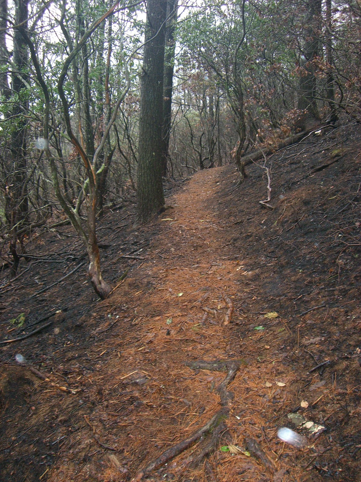
About four or five miles in, the Benton McKaye Trail split off and we headed east away from it, still going along a ridge with steep inclines and descents. Soon we would pass Mulky Gap and here's where the terrain became interesting. Apparently, there had been a forest fire in the area not too long ago and we ran through a black, charred forest for several miles. Everything on both sides of the trail was just black and sooty. The previous autumn's leaves were all gone and little was untouched by the fire. I don't know when it happened, but at times you could still smell the burnt vegetation all around us.

In this part of the run, we came across a strange knot in a tree that looked like a face. Woody had run much of this trail previously and had alerted us that it was a strange site. We nicknamed it "treeface". You can clearly see two eyes, a nose and a flat smile. Bizarre! We left "treeface" behind and we would soon hit the worst of the day's climbs. Doug, who was cranking along with Woody some paces ahead of me, all of a sudden hit the wall. He let me go in front of him and for the next several miles and climbs, I would be turning back to cheer him on. Meanwhile, I was hitting a wall of my own. At a point where the trail met up with forest road 39, we took a moment to gather ourselves and eat something. I had brought peanut butter and honey sandwiches on cinnamon raisin whole wheat bread. Delish! And just what I needed. What was coming would need every extra calorie I could put into my body.

Doug and me with "treeface"
We climbed Wildcat Knob thinking it was Coosa Bald, but it wasn't. I'm not exaggerating when I describe this climb as straight up. Seriously steep climb! Once over the top, we were hoping to see the connection with the Coosa Backcountry Trail which would have meant we had gone over Coosa Bald, but there was no trail connection and after a short stint on a saddle ridge, we did begin the climb to Coosa Bald. Holy shit! This one was rough. Woody was doing fine, but this climb broke me and Doug. We were both seriously struggling. It seem to never end. It just kept going up and up. Remember, we had already done our share of climbing all day, so this one took it out of us. We thought we'd never get to the top. After what seemed like an eternity, we finally saw the granite outcroppings that mark the top of Coosa Bald (4,280 ft.) We didn't stop to enjoy it. We just wanted to get over it and hook up with the Coosa Backcountry Trail knowing that we had a mile or two of easier downhill running down to Wolf Pen Gap where we had left a gallon jug of water earlier that morning when we drove by. The run down allowed Doug and I to get our strength back some what. We arrived into Wolf Pen Gap and sat down to refill our bottles and grab another bite. We were tired. 30 miles into it and we knew we had one last doozy of a climb up to just below the summit of Slaughter Mountain and then an easier section leading up to Blood Mountain.


When we started the day, we gave ourselves eight hours to finish the entire run, but we realized this was not going to be the case. Sitting at Wolf Pen Gap, we were already eight hours in. We gathered our stuff, threw our hydration packs back on and started the climb to Slaughter Mountain. From Wolf Pen Gap, we would go about 1,000 feet again straight up with a couple of small switchbacks. Some where on this climb, Woody noticed that his Garmin died. The elevation chart you see on this page is of the run up until this point. Click here to view what the Garmin captured to this point.

Top of Blood Mountain
Up, up and up until we leveled off some what and soon the trail broke off from the Coosa Backcountry Trail. We knew there wasn't much left until it hit the Appalachian Trail again. Much of the jokes and laughter had stopped much earlier. At this point, we were just wanting to get up to Blood Mountain and down the other side to the car as quickly as possible. Also for the first time, we realized that we might have to run in the dark before we made it to the car. We came upon the Appalachian Trail unceremoniously. We put the Duncan Ridge Trail behind us and the trail on the AT changed to a rockier single track than what we had been running on all day. The approach to the Blood Mountain summit from the southside is much tamer than from the northside. It wasn't long before we reached the stone shelter built back in the 1930's and then soon after we made it to the top at 4,458 feet. The tallest point of the day and also tallest point of the Appalachian Trail in Georgia. The fog and clouds were thick and visibility was poor at the top. There wasn't much to see unfortunately.

We gladly began the descent but it was to be the hardest descent of the whole day. The descents earlier in the day were steep, but the trail wasn't technical in the sense that you didn't have to pick up your feet much. However, the descent off Blood Mountain was not only steep, but you had to step down from large rocks and our legs were pretty chewed up. Adding to this was the mud and overflowing creek water from the rains earlier that morning. Progress was slow which was killing us because we were ready to get it done. It was slowly becoming dark too.

I had brought a couple of headlamps, which I let Woody use one of them. Except he wasn't having trouble with the dark and soon got ahead of me and Doug. When we hit the side trail that led to the Byron Reese parking lot we were thrilled. This was it, the last mile of the day and finally some runable trail. The rain had started again and we did cross some creeks on the way down to the parking lot. One switchback, then another, and we were getting excited again. Finally, we heard Woody "woot!" and we knew were back at the car almost 36 miles later and countless feet of climbing and descending. Ten and a half hours of the
Duncan Ridge Trail left a mark on us.

Doug had brought a cooler with some of his home brewed lager. We toasted, drank and busily changed into drier clothes. Here's my Dailymile post from that evening:

"Epic. Is that too strong a word? Memorable. OK, that's more appropriate. Wow! What a day? Woody, Doug and I ran the Duncan Ridge trail in N. Georgia. "Run" is loosely defined term here. It was more like run/hike/crawl. Mother nature handed it to us with rain, wind and fog. The DR trail is a beast of a trail. We hit insane climbs (13,000+ ft.) and quad-busting downhills. It took us a lot longer than intended, but we got it done. Now we are on our way to a grande Mexican meal and a cold one."

These types of runs is why I started this blog. Thanks to my running mates, Woody and Doug, for another trail adventure to remember.