The idea sprouted from Woody's head back in October. It blossomed when he shared it with me and Doug to run the entire section of the Appalachian Trail that resides in Georgia. The full 2,100+ mile trek formally begins at Springer Mountain in Georgia and ends at Mt. Khatadin in Maine. The Georgia portion is only 76 miles. 76 miles that undulates between 2,500 feet at its lowest point to almost 4,500 feet at its highest. Southbound would be the chosen direction for the run, as it would be the "easier" direction. Close to 28,000 feet of climbing and a bit more of the same in downhills. That’s almost up and back down on Mt. Everest. Daunting.
Background
Doug, Woody, another buddy, Andrew, and I first attempted the run back in January. The original plan included a night stay in a rented cabin and dividing the run in two sections. We were to start at Blue Ridge Gap which is just 3 miles from the NC/GA stateline and the last spot in Georgia where the trail meets a forest road only accessible by car. The plan was to run North, hit the stateline and then make our way South to Springer Mountain. The whole route would total about 80 miles. We had everything figured out: drop bags, pacers to come up on Saturday to help run on Sunday, overnight stay, food and water but ultimately, we weren't prepared for the weather. It all went as planned for most of the first day until we passed Chattahoochee Gap. Night settled in and a snow storm began to drop a few inches. May not sound like much, but those few inches, combined with very cold temperatures, put the kabash on the run. We made it 44 miles and arrived at Hogpen Gap, where we had to call our friends, Jon and Lane, who were at the cabin waiting to pace us the next day to come get us. Running in the cold is OK, but when your feet are wet and then frozen, it's no fun. So we had to postpone the idea for another day. That day would come again in mid-March.
Second Attempt
It wasn't long before we had a new date and a new plan. Saturday, March 14th and Sunday, March 15th became the target weekend for the run. This time we would try running through the night and have a crew follow us along the way. We would start at Deep Gap in North Carolina, once again run southbound and end the run at Springer Mountain, whole journey totaling just over 83 miles. We designated nine aid stops along the way.
The original running line-up changed slightly when Andrew decided he would come up late on Saturday to run with us from Hogpen Gap. In his place, our buddy Jon filled his spot. My wife, Stacy, and several others signed up to crew with a few of them planning to pace us during sections.
Deep Gap, NC (4,600 ft) to Blue Ridge Gap, GA (3,020 ft) - 9.9 miles
We chose Deep Gap because it could be reached by a forest service road and it was the first point we could enter the trail on the NC side. We learned the week before the run that the forest service road is closed from mid-October to mid-March. Woody called the park rangers in NC and confirmed that the road would be opened on Monday after our run...bummer. We left Atlanta at 6:45am, a bit later than we intended. The plan was to try to be on the trail by 9:30am hoping the gate on the forest service road would be close to the trail. When we arrived, we found the gate is about a mile in off US 64, but five miles from the AT. This meant Springer Mountain would now be about 88 miles away. Two men in another vehicle pulled up about the same time. They were locals helping emergency units respond to a call from a hiker on the trail needing rescue due to a blood sugar problem. Clay county EMS and park rangers were already up on the trail looking for him. Although concerned for the hiker, we were excited as our journey was about to begin. Stacy dropped us off and we were on our way.
A note on the weather, we knew that the weekend called for cooler temperatures and a bit of rain. The bit of rain would be more than that by the end of the day, but more on that later. When we started our run, it was cloudy with a misty drizzle and temperatures in the 40's.

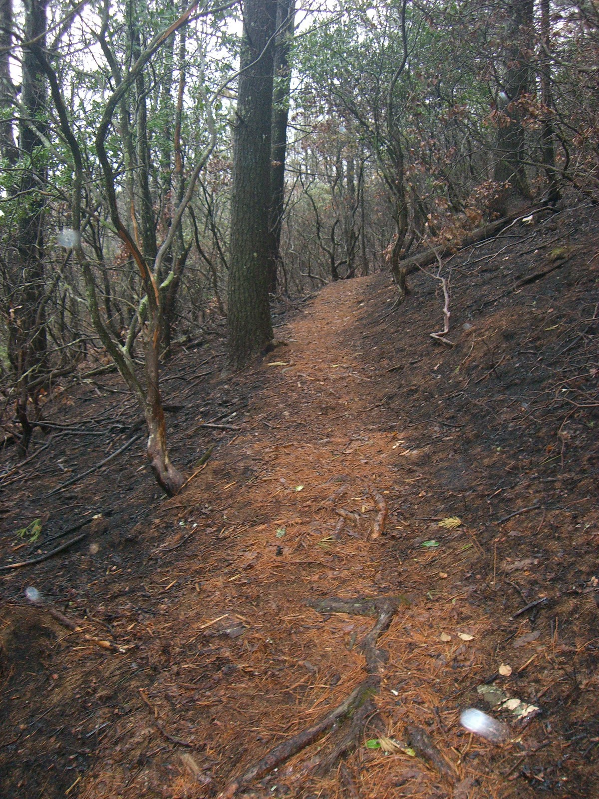
We passed the gate and hit the forest road. It was very soft and somewhat muddy due to the weather. We could see the tracks from the rescue vehicles. The forest road started to climb almost immediately. About 45 minutes in we were amazed to see an ambulance. There was a park ranger near by and he told us they had to use a wench three times just to get it to this point. We kept going and finally came to the point where the forest road ended. There was a pick up truck there with no one inside and with several decals proving the owner was a fireman. We didn't see any white blazes indicating the AT but we had to choose from three trails, two with blue diamond blazes and one unmarked. We weren't sure which one to choose and apparently missed this in our hiking guide books. We tried the unmarked trail first and after about five minutes down the trail realized that it was a dead end. Then we tried one of the blue blazed trails and ran down it for almost 10 minutes. No AT to be found down this trail, so we turned around again. Finally, we went up the only choice we had left and just a few yards up the hill was the AT. A welcomed site as we probably tacked on about 2 miles plus the five coming up to this point. Anyway, we were finally on the AT. Next stop Blue Ridge Gap.
A couple miles down the trail, an ATV was coming towards us. We figured it must be part of the rescue team and sure enough, the driver of the ATV was carrying a passenger, the affected hiker. He stoped as we let them by, and asked where we were heading. We told him we were heading south and he looked at us oddly and asked, "Where are your packs?" We didn't tell him we were running it and just  mentioned that we had a ride waiting for us past the stateline. After some encouragement to the hiker, we moved on, hoping that we wouldn't have to experience something similar first-hand. We came across another ATV and several members of the rescue team a mile or so later. Once past them, we didn't see anyone for a while.
Things were going as planned and everyone was feeling good. Because of the mist, visibility was poor off the ridge. We couldn't see what would normally be fantastic views. However, we were in good spirits and quickly closing in on the stateline. Right before Bly Gap (3,840 ft), we stopped at this bizarre shaped tree, took some photos, Woody posted to Twitter from his phone and we carried on. Soon afterwards, we came to the part of the trail where a sign says, "NC/GA". This meant a couple more photos. I received a call from Stacy and learned that she had met up with another friend, Nancy, as planned and they were now waiting for us at Blue Ridge Gap, just three or so miles from where we now were. Most of the trail from here is down hill so we were making good time. The first of many thru-hikers were appearing on the trail. Many AT thru-hikers begin their journey from Georgia to Maine in March to beat the hot summer months. It was strange to think that what these hikers were covering heading northbound in their first week, we  were attempting to cover heading southbound in less than two days.
After passing a few more thru-hikers, we came across a bizarre little "greeter" someone had placed off the trail. It was a stuffed animal wearing a hard hat with a sign, "Boo-boo wishes y’all Good Luck thru-hike". We got a good chuckle from it and had to take a few pics. Shortly after, we came down the hill and into another forest road crossing, Blue Ridge Gap. Stacy and Nancy were waiting for us with coffee and munchies, a welcomed sight! Another vehicle was there helping some thru-hikers, a young girl and two guys, father-son duo from Maine. First section and 17 miles in the bag.
Blue Ridge Gap (3,020 ft) to Dicks Creek Gap (2,675 ft) - 5.8 miles
Coming out of Blue Ridge Gap is a bit of a climb but once over the ridge and across Plum  Orchard Gap (3,100 ft), a long and steady drop begins on the way to Dicks Creek Gap, the second lowest point on the Georgia AT. This section is short and we knew we would see our crew soon. So we took it easy, hiked the climbs and ran the downhills. We made good time and almost surprised our crew. They had just set up a tarp and had begun boiling water for soup on a camping stove. The soup was incredibly revitalizing. The morning drizzle and mist was starting to sink in and the soup warmed us up. Thru-hikers had also arrived and were resting before tackling the hill we just came down. Someone had left a case of Coke and beer off the road and the thru-hikers were helping themselves.
Doug had begun to have stomach troubles before arriving at Dicks Creek. He thought that eating something would settle it, but it was to be a lingering issue for him down the trail. Once fed, we grabbed our gear and helped Stacy and Nancy put a few things back in the cars. It was time to cross US 76 to continue our journey. Second section complete and 23 miles behind us.
Dicks Creek Gap (2,675 ft) to Tray Gap (3,841 ft) - 12.2 miles
The next 12 or so miles are some of the toughest on the trail. The biggest challenge on this section is Tray Mountain (4,430 ft.). But before we hit that evil climb, we would have some work to do. The trail out of Dicks Creek Gap immediately begins an ascent up to Powell Mountain (3,840 ft), a climb of over 1,100 feet in just a few miles. Needless to say, it was slow going and not much running at this point. Once over the top, the trail eases up a little as we made our way into Deep Gap (3,350 ft). The weather was still a bit misty and overhead it was cloudy, but it would end up being the best weather of the day. We took turns at the front and made decent progress, considering the climbing involved. There were two more significant climbs before we finally made it through Addis Gap (3,300 ft) about 5.5 miles after our last aid stop. From here, the trail feels like a roller coaster, going up and down between 3,600 and 3,800 ft. As we were nearing the climb to Tray Mountain (4,430 ft), Doug let us know that he most likely was not going to continue. He was not comfortable with his stomach issues and on top of that, he was beginning to have trouble with stiffness in his legs. The rest of us were saddened by this decision and we hoped that when we arrived at the next stop, he would recharge his batteries and continue with us. 
The climb up Tray Mountain is not a steep one, as the trail makes a series of large step climbs along the ridge to this point. However, we had already been on the trail for 30+ miles and at this point, any incline was tough. We reached the summit of Tray Mountain and did not stick around except for a photo or two. Unfortunately, the view at the top was nonexistent due to the clouds and mist. We regrouped and began our descent, knowing that in just a couple miles down the hill, our crew was waiting for us at Tray Gap.
When we came off the trail into the open at Tray Gap, there was no one there. All kinds of thoughts flooded my brain, I was wondering if I had given Stacy wrong directions, or worse, if something happened to her and Nancy. To make matters worse, I could not get any signal from my cell phone.
We knew the trail hit the same forest road just another mile down the trail. Perhaps, they would be down there. To our relief, this was the case. Once again, soup, coffee and smiles from Stacy and Nancy to make us feel like we hadn’t just covered 35 miles. Doug didn’t change his mind and at this point, he decided to pull off the trail. After a change into dry clothes, Woody, Jon and I headed off to tackle one of the tougher challenges on the trail, Rocky Mountain (4,017 ft).
Tray Gap (3,841 ft) to Unicoi Gap (2,949 ft) - 4.4 miles 
Leaving Doug behind with the crew, we hit the trail and soon came across Indian Graves Gap (3,120 ft). This meant the start up Rocky Mountain. The climb is not particularly long, but it is steep with footing being an issue. There’s plenty of bald granite and the rain made it slippery. We were glad to make it to the top and had a long descent in front of us. The sun was beginning to settle and we knew that by the time we made it down and into Unicoi, it would be dark. It was time to turn on the headlamps. We ran down without much issue except for our eyes adjusting to the lights. Coming into Unicoi Gap, we actually beat our crew there, although they soon arrived. At this point, we had logged close to 40 miles.
 We helped the crew set up and enjoyed some munchies and more soup. If you’ve never tasted a real Coke after 40 miles, you are missing out. It hits the spot. At this point, the temperature was beginning to drop. The drizzle would soon turn into rain and our adventure would take on a more somber tone. We put our packs back on, crossed US 17/75 and got back on the trail.
Unicoi Gap (2,949 ft) to Hogpen Gap (3,480 ft) - 13.8 miles
Blue Mountain tops off at 4,020 ft. The trail coming out of Unicoi Gap begins ascending to Blue Mountain almost immediately. This section of the trail is very rocky and with the rain and darkness, it was to be very slow moving on this section. Woody was having some trouble with a stiff knee and he tried to loosen it up. Jon and I were feeling OK, although our wet clothes and the cold temperatures were definitely having on effect on us. We finally made it over the top of Blue Mountain, but there were more rocky sections to get through. At one point, I was leading, Woody was in the middle and Jon was trailing. We were probably about 20 yards apart from each other, when all of a sudden we heard a terrible scream. I turned around and saw Woody’s headlamp disappear in the other direction. We could barely see Jon’s headlamp and he continued to scream in pain. Woody and I made our way back to him. Jon was complaining about his knee; it seems that he fell on the rocks and banged it pretty good. Woody and I feared the worst and thoughts of carrying Jon out were going through our heads. Luckily, his knee was sore but he could walk and eventually still run on it. We had a good scare though. 
I knew if we could get to Chattahoochee Gap (3,520 ft), that we would soon have a long, steady downhill where we could get some good running in and make up some time. We passed the gap with no further incident and went up a short climb. Soon we were on the downhill which was the point back in January where we began to have trouble with the snow. This time instead of snow, it was rain. It wouldn’t stop and it seeped in to our clothes. It also became very cold. The rain was affecting all of us, but it was taking its toll particularly on Jon. Jon has blood circulation issues due to his diabetes and he was losing feeling in his fingers. Also, we were running out of water because of the slow progress going up Blue Mountain. We crossed Low Gap (3,032 ft) and had another 4 miles to go until Hogpen Gap where Stacy and some fresh troops were waiting for us. Earlier in the week, I had asked these guys to bring a sack of cheeseburgers for when they met us at this stop. All I could think about were those cheeseburgers. Meanwhile, Jon’s condition was getting worse. We did not run much on these last few miles to Hogpen Gap. We were marching along in somewhat of a down mood. Suddenly, we saw two headlamps coming our way. Two of our friends, Luis and Roxanne, had decided to venture up the trail to come towards us. Talk about lifting your spirits! They were a blast of renewed energy and we finished the last mile or so with their help. As we made our way off the trail, we could see several sets of headlights and our friends, Luis, Anna, Roxanne, Andrew and Stacy, welcoming us. It was good to see them! We were freezing and immediately got into cars with coffee and hot chicken broth. 54 miles traveled so far on our tired, wet, frozen feet at this point. 
Jon was done, although he eventually ended up being OK once he got some hot food in him and dry clothes on. Woody and I were coming back to life and began to prepare to hit the trail once again. I was excited because we would have fresh legs join us. Andrew, who had run with us back in January, and Roxanne, an experienced ultra-runner, were going to help us from here on out. I downed two cheeseburgers with my broth and changed into a new set of dry clothes. It was still raining outside, but I was feeling better and ready to go. I jumped out of the car with Andrew and saw that Roxanne and Woody were also ready. We had to head down a bit on the road before finding the trail.
Hogpen Gap (3,480 ft) to Neel’s Gap (3,125 ft) - 6.4 miles
Getting out of the cars, brought me right out into the wind and all that cold hit me like a ton of bricks. I had three violent shiver spasms, but I kept moving. Woody was having the same problem plus his hip flexor was bothering him. He decided to go back to the car. While Andrew went to check on him, I followed Roxanne. Roxanne and I struggled to find the trail for a second, but once Andrew was back, he guided us up the right way. We learned from Andrew that Woody was going to sit this section out and see about joining us at the next stop. That left me to complete the journey. Even though I had Roxanne and Andrew with me, I have to admit that it did affect me some to not have my adventure partners on the trail with me. I shrugged it off and just stayed focused on following Roxanne. Andrew brought up the rear. On the trail, the cold wasn’t bothering me as much and I was able to get into a comfortable pace.
The rain was a factor for sure. The trail was full of water and it seemed that we were running through a creek. Due to the wet conditions, my feet were getting waterlogged. We hit two big climbs on this section Wildcat Mountain (3,730 ft) and Cowrock Mountain (3,852 ft). This second one was unbelievably steep and I had a hard time getting up it. Once over the top, we began a long downhill into Neel’s Gap. Roxanne and Andrew were incredible. They kept me going with encouragement and jokes. I really needed it. This down slope seemed to go on forever and I thought we would never get to Neel’s Gap and the rest of our team. Andrew pointed out some lights in the distance and said we were almost there. At Neel’s Gap, the famous hostel/outdoor gear store, Walasi-yi, sits right on the trail. I knew that once I was on its stone paved path that I would be back in the warmth of a car with soup in my hand. The rain was still pouring down and when we finally arrived at the store; our crew was all either asleep or trying to stay dry and warm in the cars. I got into a car and tried to warm up. Andrew got in the same car and Jon was in the front seat. I took off my socks and shoes and saw that my feet were swollen and waterlogged for sure. I was feeling the 60 miles I had run and hiked all day. Andrew asked me if I was planning on continuing and told me he would join me if I did . I wasn’t sure. My feet were not in such good shape. I knew that we had the toughest climb of the day yet to come, Blood Mountain (4,458 ft), the tallest point on the AT in Georgia. I thought about Doug, Woody and Jon and wished we were all doing it together. I thought about our crew toughing it out and supporting us at the next few stops, the last 20 miles of it on muddy, very wet forest service roads. I thought about my wife, Stacy, who had been such a trooper crewing all day and into the night. I thought about the almost 30 miles still to go to Springer Mountain. Finally, I looked at Andrew and told him I was stopping here.
It was five o’clock in the morning. I had conquered 60 miles of the trail, Jon and Woody 54 miles and Doug 35 miles. We had given it a hell of a try. Even though we did not finish what we set out to do, I still had a great time with good friends. I wrote earlier that completing the trail along with its elevation changes would be climbing and descending Mt. Everest (bare with me, I know it’s not quite the same). The point is Sir Edmund Hillary didn’t reach the top of Everest on his first try either. We just need to regroup and one day we will enter the trail again in North Carolina and end up at the top of Springer Mountain without doubt. Just need some kind help from the trail weather gods.
My gratitude to Luis, Anna and Nancy for being crew extraordinaire. To Roxanne for pacing. To Andrew also for pacing and for being a part of the adventure from the very beginning. To my wife, Stacy, for putting up with this crazy idea, crewing all day and night and supporting me. And to Jon, Woody and Doug, you guys rock! Cheers and happy trails!